Trail Map & Stats
Four chairs, 26 runs and 2,100 feet of vertical on the only resort in SoCal with true high-alpine terrain.
2,100′Total vertical
600Skiable acres
26Runs
170″Average snowfall
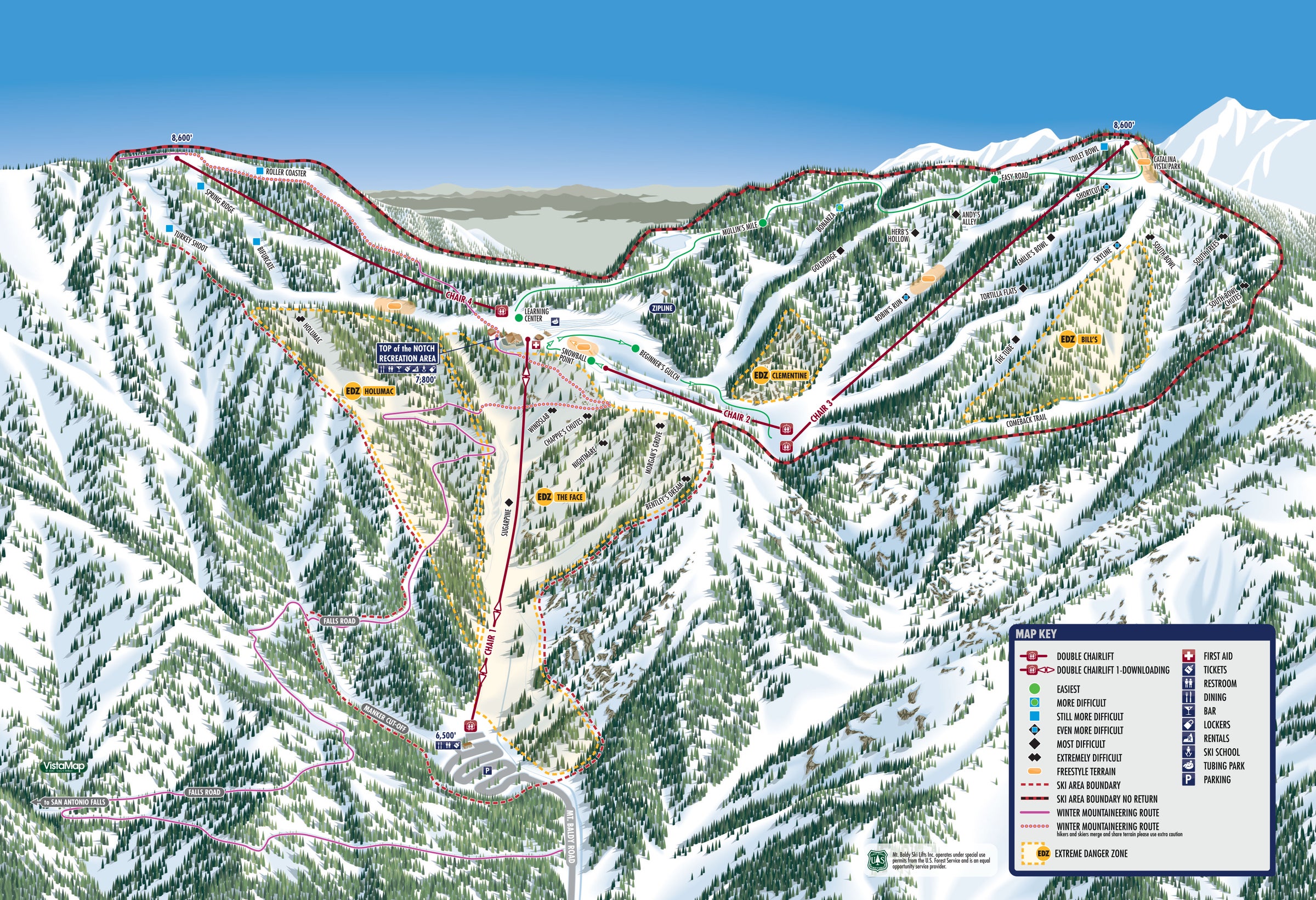
Trail map
Tap the map to open it full size.

The chairs
Elevations in feet.
| Chair | Name | Base | Top | Vertical |
|---|---|---|---|---|
| 1 | Sugar Pine | 6,500 | 7,800 | 1,200 |
| 2 | The Gulch | 7,550 | 7,850 | 300 |
| 3 | Thunder Mountain | 7,520 | 8,600 | 1,080 |
| 4 | West Side | 7,660 | 8,560 | 900 |
Know the zones
Real alpine terrain
Baldy has the most dramatic changes in slope and exposure of any resort in Southern California, so we use area and zone designations like high-alpine resorts around the world.
Along with some of the friendliest learning zones in the region, the mountain has Extreme Danger Zones. Going in raises the risk of injury or death, and rescue may not be possible. Learn the signs and zone markers before you ride.